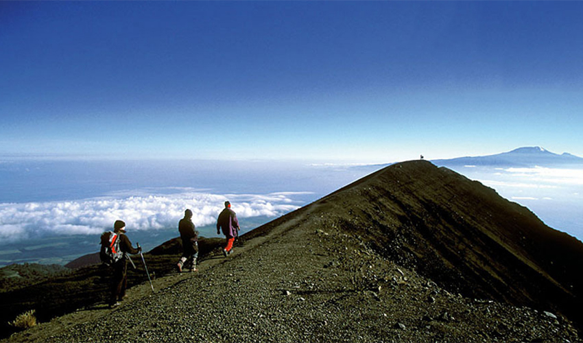
The Machame route, commonly referred to as the “Whiskey route”, is one of the most popular routes on Kilimanjaro routes. Despite being a challenging climb compared to the Marangu route, the Machame route has one of the highest summit success rates landscape which allows climbers to “trek high and sleep low” hence making it a more favorable route for acclimatization.

Mountain Gear Check-list

  • A Rucksack for Your Equipment – To Be Carried By Porters
  • Sleeping Bag [Mountain Type], Day Pack – For Your Personal Items
  • Hiking, Climbing Boots, Camp Shoes, Trainers Not Sandals
  • 2 Thin Polypro Type For Quick Drying, 4 Thick Wind Pants, Wind shirts
  • High Gaiters, Warm Pants [Fleece], Jacket Or Pullover, 1 Rain Parka
  • 2 Underwears,1 Hiking Shirt, Long Sleeve, 1 Bandanna
  • 1 Warm Hat, 1 Hiking Shorts, Pants, Balaclava, Fleece Neck Warmer
  • Headlamp, Bulb, Batteries, First Aid Kit, Pocketknife, Sunglasses, Snow
  • Goggles, Water Purification Tablets
  • Toiletry Item, Plus Sunblock, Lipsalve, and Moisturizer
  • Walking Stick
Day 1

Arusha - Machame Camp

Elevation (m): 1830m to 3100m
Distance: 18km
Hiking Time: 5-7 hours
Habitat: Montane Forest
The drive from Arusha to the Mount Kilimanjaro National Park Gate takes about 50 minutes. The journey passes through the village of Machame which is located on the lower slopes of the mountain. We now leave the park gate and walk through the rain forest on a winding trail up a ridge. Lower down, the trail can be muddy and slippery. Gaiters and trekking poles are a good idea here. We continue a short distance until we reach the Machame Camp.
Day 2

Machame Camp - Shira Camp

Elevation (m): 3100m to 3840m Distance: 9km Hiking Time: 4-6 hours Habitat: Moorland After breakfast, we leave the glades of the rain forest and continue on an ascending path, crossing the little valley walking along a steep rocky ridge, covered with heather until the ridge ends. The route now turns west onto a river gorge. Time for rest, dinner, and overnight at the Shira campsite.
Day 3

Shira Camp- Lava Tower - Barranco Camp

Elevation (m): 3840m to 4630m to 3860m Distance: 15 km Hiking Time: 5-7 hours Habitat: Semi-desert From the Shira Plateau, we continue to the east up a ridge, passing the junction towards the peak of Kibo. As we continue, our direction changes to the South East towards the Lava Tower, called the "Shark's Tooth." Shortly after the tower, we come to the second junction which brings us up to the Arrow Glacier at an altitude of 4876m / 15,997 ft. We now continue down to the Barranco Hut at an altitude of 3860m / 12,664 ft. Here we rest, enjoy dinner, and overnight. Although you end the day at the same elevation as when you started, this day is very important for acclimatization and will help your body prepare for summit day. After breakfast, we leave Barranco and continue on a steep ridge passing the Barranco Wall, to the Karanga Valley campsite.
Day 4

Barranco camp- Barafu camp

Elevation (m): 3860m to 4600m Distance: 13km Hiking Time: 8 hours Habitat: Alpine Desert After breakfast, we leave Barranco and continue on a steep ridge up the Barranco Wall, through the Karanga Valley (lunch at 4200m / 13,779 ft), and the junction which connects with the Mweka Trail. We continue up to the Barafu Hut. You have completed the South Circuit, which offers views of the summit from many different angles. Here we make camp, rest, enjoy dinner, and prepare for the summit day. The two peaks of Mawenzi and Kibo are to be seen from this position.
Day 5

Barafu camp- Summit Uhuru peak 5895M - Mmeka Hut

Very early in the morning (midnight to 2 am), we continue our way to the summit between the Rebmann and Ratzel glaciers. You head in a northwesterly direction and ascend through heavy scree towards Stella Point on the crater rim. This is the most mentally and physically challenging portion of the trek. At Stella Point (5685m / 18,652 ft), you will stop for a short rest and will be rewarded with the most magnificent sunrise you are ever likely to see (weather permitting). From Stella Point, you may encounter snow all they way on your 1-hour ascent to the summit. At Uhuru Peak, you have reached the highest point on Mount Kilimanjaro and the continent of Africa. Faster hikers will see the sunrise from the summit. It can be very cold at night at these elevations, but it will be quite warm by the end of the hiking day. You will want a clothing for both extremes with you. From the summit, we now make our descent continuing straight down to the Mweka Hut camp, stopping at Barafu for lunch.
Day 6

Mweka Camp – Arusha

Elevation (m): 3100m to 1830m Distance: 15 km Hiking Time: 3-4 hours Habitat: Forest After breakfast, we continue the descent down to the Mweka Park Gate to receive your summit certificates. At lower elevations, it can be wet and muddy. Gaiters and trekking poles will help. Shorts and t-shirts will probably be plenty to wear (keep rain gear and warmer clothing handy). From the gate, continue another hour to Mweka Village. A vehicle will meet you at Mweka village to drive you back to the hotel in Arusha.

Included in the Safari Cost

  • Transport to & from the mountain
  • Porters, Guide & Cooks Fee
  • Three meals a day whilst on the mountain
  • All hut & camping fees
  • All park entry fees
  • Sleeping Bag
  • Certificate of achievement
  • Mineral Water

Excluded in the Safari Cost

  • Tipping to the guide & porters, cooks
  • Personal climbing gear – clothing’s & rucksack
  • Personal travel insurance
  • Beverages
  • Items of personal use.

For more information:

Please contact us on email info@tropicalwildexpeditions.com or phone (+254) 721 411 044

Hits: 49